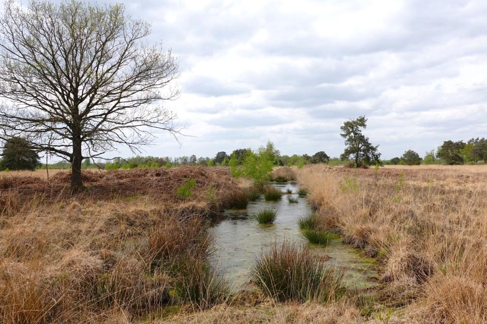
From Impenetrable Swamp to a Landscape Full of Stories

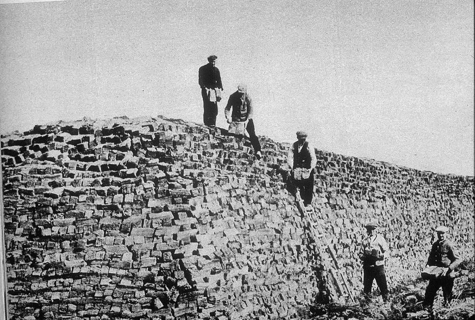
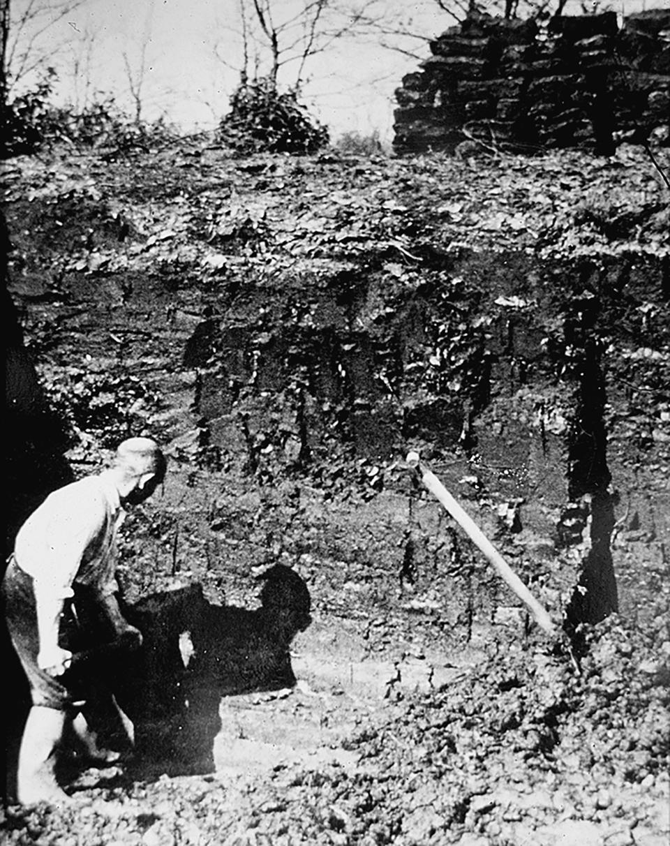
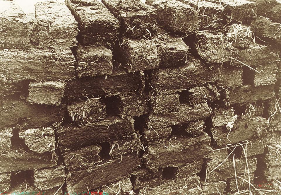
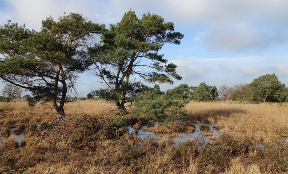
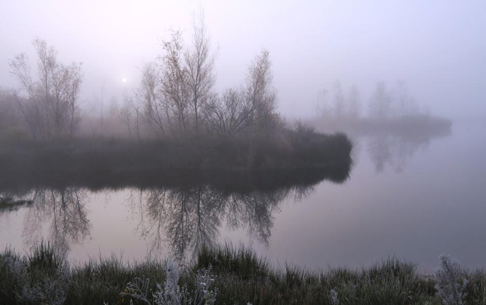
For centuries, De Peel was a rugged, wet, and impenetrable raised bog marsh. The Romans called the area 'paludosus', meaning swampy region, which likely later became 'Peel'. A place that was hard to access, where you didn't want to get lost and could hardly live. Until the black gold of De Peel was discovered. The landscape gradually transformed into an area where people worked, lived, and later even fought for freedom.  

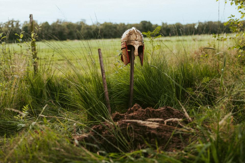
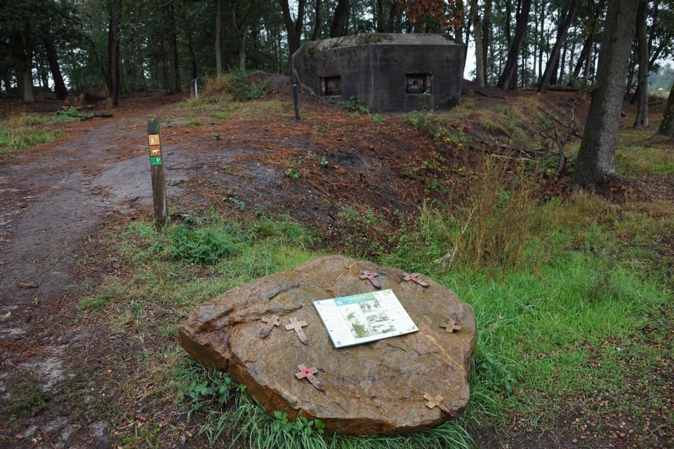
Discover the history and mystery of De Peel through stories about peat-cutting, legends such as white women and will-o'-the-wisps, and the struggle in the Second World War. And see with your own eyes the scars of history in the landscape of De Peel. 

Rising sun in landscape with dew on grass
plaintext
Marijke Vaes

Peat Cutting: the Hard Work That Shaped De Peel

In the raised bog of De Peel, you once found a meters-thick peat layer, consisting of old plant remains. As early as the 13th century, people discovered that you could dry peat to make turf, and that turf burned well. For a long time, peat was cut on a small scale, mainly for personal use.  

Black Gold Rush

'Black gold' became increasingly important as fuel, and thus more and more peat was extracted. The peak of peat extraction was between 1850 and 1930, when there was not much forest and therefore little firewood left. On Brabant soil, this was done on a large scale by the company van der Griendt, which dug long straight canals and channels to transport the peat. On the Limburg side, every farmer dug peat on his own leased piece of land and transported it in a cart. This resulted in peat pits of various sizes and narrow 'peat paths' scattered across De Peel.

Additionally, the population grew, and more industry emerged. Thanks to the construction of various canals, such as the Zuid-Willemsvaart, Helenavaart, and the Deurne canal, connections were created for transporting the peat. Moreover, machines were built for peat extraction.  

Oude zwartwitfoto van turfstekers die op en naast grote stapel turf staan
Staatsbosbeheer
Oude zwartwitfoto van turfsteker die turf afgraaft
Staatsbosbeheer
Oude zwartwitfoto van stapel turfblokken
Staatsbosbeheer

From Peat Industry Back to Nature

At the beginning of the 20th century, there wasn't much peat left. All the work drastically changed the landscape. From a densely vegetated raised bog marsh to an open and water-rich area. They started cultivating the excavated parts to create meadows and fields. However, 4,000 hectares were preserved as a nature reserve. In 1993, 1,400 hectares of this were designated as National Park De Groote Peel.

Learn More About Peat Cutting

In the Landscape

If you walk through the area today, you'll still see large water bodies, small peat pits, and long lines (peat lanes and canals) as 'scars' of the peat cutting past. You can even see the difference between the Brabant and Limburg peat extraction in the landscape.

Names in the area also date back to the time of the peat cutters. For example, the water body 'Aan ’t Elfde' in De Groote Peel, which was once designated as the eleventh plot where peat could be cut.

Back in Time

Various (open-air) museums offer a glimpse into how peat cutters used to live and work. For example, Museum Klok & Peel, the Toon Kortooms Park, and the Peelmuseum

Vaart in hoogveenlandschap
Marijke Vaes
html
Water body with birds and birches along the shore
Peel landscape with marsh and trees

Sages & Legends: the Swamp Mystery of De Peel

Although De Peel became increasingly accessible and more people lived and worked there, it remained a sinister area. Mist, swamps, and endless plains made it a place where you easily got lost. After a hard day's work, all sorts of stories emerged. About mysterious figures in the distance, eerie sounds, and people who entered De Peel and never returned. In a time without TV, radio, or internet, the stories were passed on by word of mouth. And so the stories became more thrilling from generation to generation. 

Stories that make you lose your way

As soon as the sun disappears and makes way for the dark, they emerge. From the deepest recesses of the earth, the mire bubbles, from which wailing spirits rise. Mist transforms into "witte wieven," souls of women who have not yet found rest. One warns you of danger, while the other tries to lure you deeper into the swamp. Will-o'-the-wisps can also lead you astray. Those who know the secret of the swamp know that these flickering lights are actually burning swamp gas. But even with that knowledge, the Swamp Mystery of De Peel remains undiscovered, and the landscape easily puts you to the test. 

Misty landscape by the water
Marijke Vaes

A real find: the Roman helmet

In 1910, peat digger Gabriël (Gebbel) Smolenaars from Meijel discovered a Roman gilded silver parade helmet near Helenaveen. It is thought that the helmet was an offering, but other stories also circulate. For instance, the wandering knight is said to still roam De Peel, searching for his lost helmet.

Discover the mystery during this cycling route. Visit the discovery site or view replicas and experience stories at Museum Klok & Peel and Museum Peel en Maas

Two peat cutters in meadow with golden helmet
Willeke Machiels
Golden helmet on pole next to meadow in nature
Land of the Peel

The Second World War: Battle in an Inhospitable Landscape

Beneath the tranquility you find in De Peel today lies a history of struggle. During the Second World War, De Peel was one of the regions that saw the heaviest fighting after Normandy. The impenetrability of the landscape made it a strategic area. The landscape offered shelter, but also danger. 

A line through the marsh

At the beginning of the war, De Peel was part of the Peel-Raam line. A long defensive line of bunkers, trenches, and obstacles from Grave to Weert. The marshy landscape was supposed to slow down the enemy. But on May 10, 1940, the first day of war in the Netherlands, the line fell.

Belfort Vossenberg

At the 22-meter high Belfort in Meijel, you will find six bunkers that were part of the Peel-Raam line. The firing positions are also still visible here, where soldiers were only protected by a shield. And walk an escape route, which centuries before was already essential for peat extraction in De Peel. 

Observation tower Belfort Vossenberg among trees
Belfry Vossenberg
Landschaft with casemate and flat stone with sign and crosses on it
The context text `Belfry of Vossenberg
Kazemat
Belfry Vossenberg

Death Valley De Peel

During the intense air and ground war between 1940 and 1945, a large number of aircraft crashed here. The area was therefore nicknamed Death Valley. Some of these crash sites are still visible in the landscape. For example, in De Mariapeel, where a monument marks the crash site of a British aircraft. A network of cycling routes with a total of 400 km tells the story of Death Valley De Peel.

Discover more about World War II in De Peel

Various museums tell the story of the war in the marshy Peel:

War Memorial in a High Moor Landscape
<p>The context text <span title="Simone Wittgen">Simone Wittgen</span></p>